

OLD FLORIDA TOWNS ON A1A and US-1 Fernandina to Miami and Key West
This is a trip that I and my friends took several years ago on a Sat. on out monthly Lady’s Day Out—-I have tried to check that everything is still there and given you modern sites to learn about most of the places I mention—-I don’t think there’s anything major that Hasn’t been documented, but if you ever decide to do the trip you might want to just document what’s happening along the way—be sure of where you go is always a good thing.
As I keep insisting you have to take the road less traveled to find the best and most interesting adventures and today we are really going to follow that road—-from Tampa, Orlando that area you can take I-4 to Daytona Beach and then North on 95—-If you below Daytona on the east coast of Florida you can take 95 to Route 16–the last St. Augustine exit then South on Route 1 till you get to A1A which crosses the Tolomato River and then turns north.
A1A is in my opinion one of the best sightseeing route in Eastern Florida, but what was once a main route had become a lesser known and even less traveled route—though you can drive it along the entire East Coast on this two lane highway. It hugs the beaches and wanders through the beach resort towns as well as the villages that are mostly included in their intersection and if you open the window or put the top down you might actually hear the surf from time to time—-not to mention the sea breeze.
Except the big towns that it goes thru, driving on A1A is life taking a big step back into time before there were interstates, internet, an drones flying over your head. It is often just two lanes, and runs thru what a lot of us remember as some of the best parts of what is now called “old Florida” including fishing camps, marinas, even a few waterfront shanties with fresh, but inexpensive southern style seafood.

Your first adventure site is on the left—-these days it’s mostly for weddings and the like but you can turn left at the next street past the castle 3rd St. If you continue to the end of 3rd and turn right on Myrtle and continue on past 2nd
A Virtual Tour Of Castle Otttis In St Augustine
Just after 2nd and on your left and setting along the Tolomato River is
which is open for lunch (from 11:30 am) on Sat and Sundays only—-so if you’re hungry you might want to check it out—-though it’s open most other days at 4:30 pm so…..
Driving down A1A

PONTE VEDRA BEACH SECRETS AND THINGS TO DO

Top 10 Things to Do in Ponte Vedra Beach Florida
This was once Mineral City, a town known for named for its heavy minerals including ilmenite,and ruttle to name a few that were harvested from its sand dunes. The name was changed in the 1930’s when it was being converted to a much classier sea side development and an architect from New York suggested the present name Ponte Verdra after a city in Spain.
During World War II this was a dangerous coast with Nazi submarines sinking ships within site of the shore and there were multiple reports of bodies and or their parts drifting ashore
Sometime near that war one of those subs landed saboteurs here (as well as in Long Island in NY). It is said that the subs were so closed they pulled the boat the saboteurs used to reach the beach back with ropes. They were said to have buried explosives here while they explored the area. They might have succeeded had not two of the members of the group alerted authorities resulting in the arrest of the entire group, whom were all quickly tried and except for the informers were executed. The informers were jailed until the end of the war when they were released and return to Germay.
And the town now lives up to its ups scale name and has deluxe golf and tennis resort
A Look Back: Nazi agents picked Ponte Vedra as landing point in 1942

Area #2: Guana River St. Park
Guana River Wildlife Management
2690 S Ponte Vedra Blvd
Ponte Vedra Beach, FL 32082
Open 9 am – 5 pm daily
Guana River State Park, Ponte Vedra Beach, Florida
#3. Ponte Verde Pointe Shopping Center
5060 County Rd 210
Ponte Vedra Beach, FL 32082
I don’t believe this one is here anymore.
The Best 10 Shopping near Ponte Vedra Beach, FL 32082

The Best 10 Shopping near Ponte Vedra Beach, FL 32082
-min.jpg)
Northeast Florida
It has been said that Nature has provided Northeast Florida with miles of beachfront, thousands of acres of unspoiled marshland and thriving estuaries that nuture oysters, crabs and fish.
Jacksonville has three beach communities that you can explore: Jacksonville Beach, Atlantic Beach and Neptune Beach which amounts to around 2 miles of white sand beaches along the Atlantic Ocean.
Here you find the Buccaneer Trail once traveled by Timucuan Indians, the French and the Spanish settlers, pirates and buccaneers fight to claim the coastline.
Jacksonville Beach Downtown Tour northbound
Hint on this one turn the sound off.

24 Hours in Atlantic Beach, Jacksonville Florida // Florida Travel Vlog

Golden sands and deep blue water and less commercial than Daytona Beach, what more can I say?! It is 18 miles SE of Jacksonville, and takes its name from that city but prior to this it was named Ruby and then Pablo Beach.

#4: Jacksonville Beach Pier
503 North 1st Street
Jacksonville Beach, FL 32250
1944 Beach Blvd
Family entertainment center with bumper boats, go karts, laser tag, video arcade and batting cage

Neptune Beach Surf Report & Forecast

Neptune Beach, Florida ⭐️🌎 AMERICAN CITIES 🌎⭐️
The name is taken (borrowed) from the King of the Sea. Since 1989 it has been operating under an elected Mayor/Council.
15 Best Things to Do in Neptune Beach (FL)

Dog Friendly Beaches in Neptune Beach, FL

Florida Travel: Welcome to Atlantic Beach & the Talbot Island State Parks
Formerly Pablo Beach for the Spanish form of Paul Pablo Beach. The Pablo was from the names of Pablo Creek and Point, both of which date from Spanish days. Ther has been a post office here since October 1884. The town was incorporated on May 22, 1907 and a paved highway from put through the town from Jacksonville in 1910. In 1925 when the town of Jacksonville Beach was incorporated both Atlantic and Neptune Beach broke away and established themselves separately.
#6 Hannah Park
Black History Month: The hidden history of Hanna Park

Exploring Northeast Florida’s Fort Caroline National Memorial
A1A turns west/left follow it until you come to route 10—and follow Route 10 Across Intercoastal Water Way—until you come to Girvin Rd where you will turn right/north—Girvin ends on Mt. Pleasant Rd. Turn Left/west—on Mt Pleasant and continue till you come to Ft. Caroline Road (if you continue forward/ straight you will be on Ft Caroline too– it turns north here—_(Mt Pleastant end at this turn in Ft. Caroline Rd) Turn right on Ft. Caroline and continue on until you come to the Ft. Caroline Memorial on the —-enter the park and following signs etc to the fort. (this whole trip to the fort is about 10 miles or a bit more one way).
12718 Ft. Caroline Rd.
Jacksonville
134 acres along the St. Johns River
This is a reconstruction of the original 16th century for that was actually located beyond the Visitor’s Center (at end of a quarter mile trail). The visitor explains the conflict between these original French settlers who built the fort and the Spanish soldiers that came later.
This settlement on the May–now the St. Johns– and founded by French settlers, with it’s Fort was established 16 months prior to the founding of St. Augustine by the Spanish. This was in 1564 when some 200 French settlers,, many of them Huguenots, established a colony under the their leader Rene de Laudonniere. They built a village and a small earthen fortification. It was not an easy time as they were plagued by hunger, mutiny and Native Americans.
When the Fort was threatened by the Spanish, Jean Ribauld the French Naval officer and Huguenot colonizer who built Ft. Charles in South Carolina and who had returned to France for awhile was sent to aid Fort Caroline. While he sailed to attack the Spanish near St. Augustine, the Spanish destroyed Ft. Caroline killing many of those inside and then they marched back to St. Augustine where they met up with the French who had been ship wrecked the Catholic Spanish are said to have massacred the French sparing only a few Catholics.
The Fort held the fort , calling it Ft. Mateo until 1568 when the French returned and took the fort back, hanging those who surrendered.
The French did not stay on but left the fort which was washed away by nature in 1880—leaving nothing of the French’s efforts and the many deaths on both sides but memories of a few remaining colonists who have all since ceased to exist as well.
This park is now part of the National Park Serves, which preserves the probable area where the original colonization took place.
The Visitor’s Center serves as the main visitors contact at the Timucuam Ecological Historical Preserve as well and contains artifacts from the time period. Their book store has multiple title on Florida’s Colonial History.
A half mile walk from the center on The Old French Trail is a recreated full size Ft. Caroline which provides of how the French tried to protect themselves from the French.
Hammock Trail is about a mile long and includes a self guided trail with informational signs telling of natural history and the culture of the area.
Spanish Pond is a freshwater wetland which might be the site the Spanish camped before taking the fort.
Ribault Column is another recreation this of a stone placed her by Jean Riault at the mouth of the river in 1552—it has a nice view from this area.
To the east of the fort—when you visit there look east toward the mouth of the St. John’s River

St. Johns Bluff around 1900.
St. Johns Bluff
in September 1862 (less than 1 1/2 years from the start of the Civil War—when a squadron of 6 Union gunboats came up the St. Johns from the Atlantic and fired upon a Confederate emplacement located atop that bluff. There was an engagement lasting about 5 hours which left the union without injury but forcing the Confederates o flee the bluff and give up control of the St. Johns to the Union.
Fort Caroline, Florida – A Short Lived Colony

Return the way you came and when you get to A1A where it turns north off 10 (where you left it before) turn left/north and continue on your journey.
Please note the next part of the trip has a couple of option—-when I set this tour up and we took it years ago it involved taking a ferry across the River from Mayport to Ft. George Island—-some of you might not be comfortable with this.
You can end your trip here or you can look at other routes—-the closest one if about 40 miles and involves the Interstate—you can google it
Or you can just end the trip here it’s been a pretty good day anyway.
If you wish to do the Ferry Just continue the directions at the beginning of this section.
And follow A1A to the St. Johns Ferry in Mayport
which is 8.3 miles from the fort.
MAYPORT, FLORIDA

The Mayport Ferry

From Mayport Village to Ft. George Island
Ft. George Island is a bit of old Florida just off A1A. Ownership of the island is shared by the National Park Service, the state of Florida and some private residents. It is part of the Talbot Island Complex. The ferry docks on Ft. George —
is estimated to have been occupied for over 5,000 Years (continuously) and it is reported that there are sites of occupation for all those inhabitants (called Alemaconi by the Native American occupants and San Juan by the Spanish). Mt. Cornelia on the island is 55 feet high and one of the highest points on the coast south of New Jersey.
The English named it (General James Edward Oglethrope of Georgia) St. George after England’s patron saint) St. George. The St. was eventually dropped and it is a true island connected to the main land by a man made causeway at the southern tip.
Fort George Island Cultural State Park


Saint George was founded in 1877 with worship services being held since 1884.
Exploring NE Florida’s Fort George Island Historical Park
Stay on Ft George
St. George’s Church is on your left you pass Palmetto Ave on your Left.
continue on —Ft George makes a sharp north west (left) turn and becomes Edgewood. Continue on until Edgewood becomes Beatty. as it crosses Palmetto—Turn right on Palmetto.
Palmetto continues on until it goes into Kingsley Plantation—just follow the signs and go to the parking area and into the plantation for a visit.
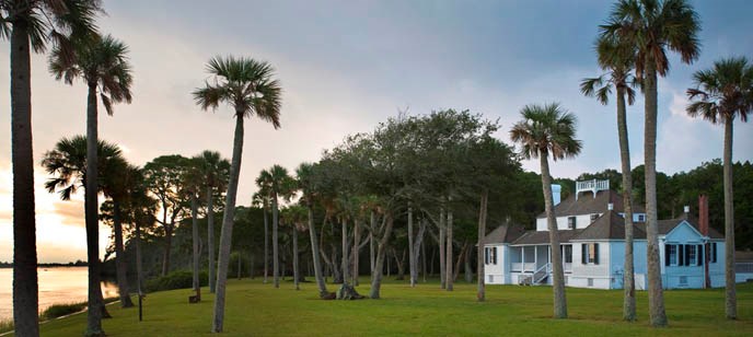 Kingsley Plantation is located along the Fort George River on Fort George Island.
Florida on a Tankful: Exploring the Historical Kingsley Plantation

Virtual Tour of Kingsley Plantation | Jacksonville, Florida
The road is oyster shell and the canopy subtropical trees and the plantation is on the river–Ft. George just like the island. It was begun in 1791 by John McQueen who got the island in a land grant from the King of Spain. The original house still stands —just check out the Kitchen House.
It is now a National Park, as you drive in on that narrow oyster shell road you’ss see a tabby house on an overhand on the left. Tabby is a mix of lime and water as well as shells which are mixed together and poured in layers and then let dry and a new layer is poured. It was built for a former owner’s daughter who died prior to the house being finished and it is said that it is now occupied by a ghost some times a lady in white and sometimes a great wolf with eyes of fire.
A second owner John Houston Macintosh left the area supposedly involved in an effort to overthrow the government.
There were many owners and more information than this already overlong already over long column , can contain. Please try the sites below to find out more.
Black History Month: 8 stops on Florida’s Black Heritage Trail
Florida’s Oldest Surviving Plantation House
Old Red Eyes And The Ghosts Of Kingsley Plantation
You can return on Palmento for a bit of a different vista on your way home—-and stay on it till you come to Fort George and turn right then right on A1A . You can either take the ferry back and return back the way you came earlier
Or you can continue on 106—A1A ends at the ferry–which is also Herkscher Dr. which after looping about a bit ends up at 295 and from there you can choose your destination home.
Interstate 295 (Florida)
